
ADUCAT - Actionable Data space for Urban Climate Adaptation
Funding programmeEUI- Innovative Actions | ClientCity of Vienna - Vienna Digital (MA 01) | DurationApril 2025 - March 2029 |
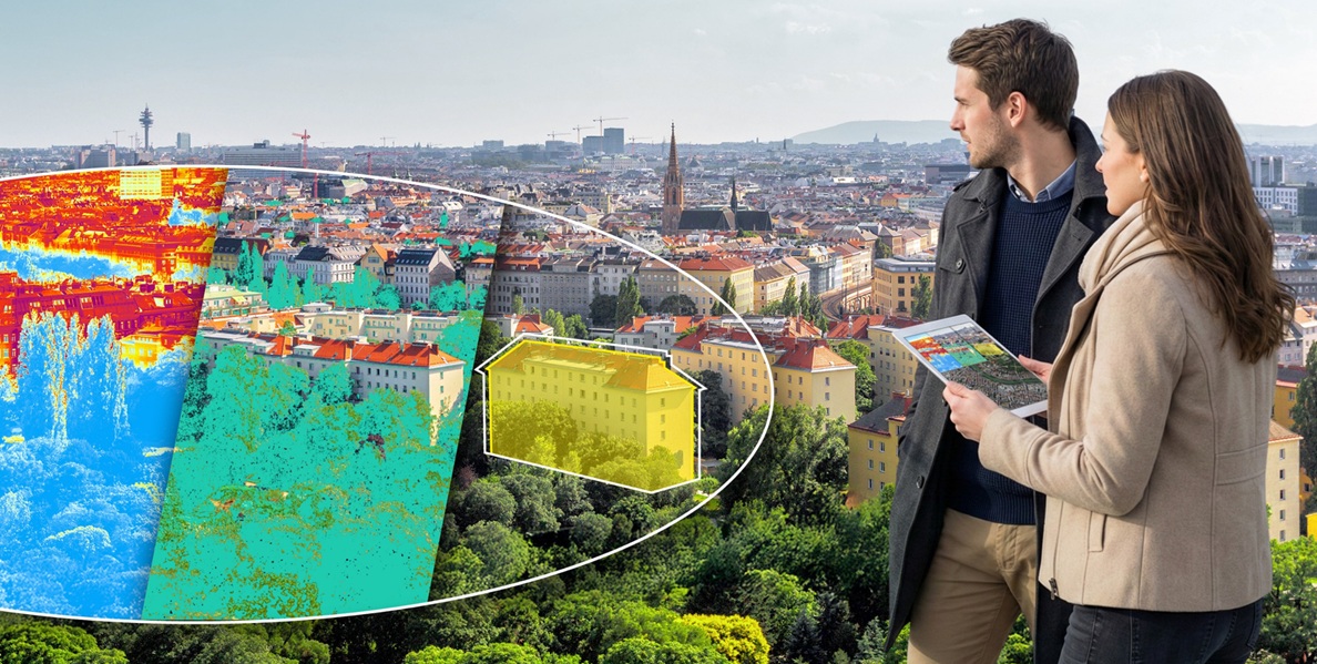
The project aims to explore, test and apply the potential of high-frequency satellite data for city administration, using three case studies from Vienna. With the involvement of three partner cities, the project will also assess the transferability of these findings to other urban settings. The aim is to enable city administrations to play a more proactive role in protecting infrastructure, combating global warming and responding to natural disasters.





EuroVienna's services
Application:
- Funding screening: As part of a funding assessment, the project idea was compared with the objectives of funding programmes and calls for proposals, and an evaluation was carried out;
- Coordination of the funding application: EuroVienna coordinated the entire consortium in relation to the project submission, drafted the application documents, coordinated the preparation of the budget and handled ongoing liaison with the funding programme;
- Partner search: EuroVienna provided support in the search for the remaining partner cities.
Project management:
- Project support and reporting: EuroVienna acts as the interface between the project partners and the funding programme. It facilitates amendments to the funding agreement and the work programme and coordinates all reporting activities.
Project summary
Maintaining and improving infrastructure and services to enhance resilience has become an increasingly important challenge for cities, particularly in the face of advancing climate change. Evidence-based strategies and data-driven knowledge are required to implement necessary measures – such as protecting infrastructure or cooling and greening urban open spaces – as effectively and sustainably as possible. In Vienna, these insights are currently being gained through very time-consuming and costly on-site measurements. As these are often carried out manually, many take place only at specific times of the year. This leads to a high degree of inaccuracy in the analyses.
The aim of this project is to utilise the potential of high-frequency monitoring using satellite data for areas of urban planning that require intensive monitoring, based on selected use cases: infrastructure safety, green space monitoring and heat monitoring. This will enable the city administration to play a more proactive role in protecting infrastructure and combating global warming in the event of natural disasters, including events similar to the recent floods in eastern Austria.
Vienna is testing how cities can use real-time environmental data to monitor key factors such as green spaces and plant health, ground movements and temperature changes. Through ADUCAT’s approach of integrating satellite data into urban processes and improving local climate action measures, cities can be made more resilient and sustainable. The project’s transferability is being tested in collaboration with the partner cities of Guimarães, Zagreb and Udine.
Results and impact
ADUCAT stands for ‘Actionable Data Space for Urban Climate Adaptation and related socio-ecological, local Transformation’ – an ambitious project that utilises satellite data from the EU’s ‘Copernicus’ space programme, artificial intelligence and machine learning to create data-driven solutions to key challenges in urban development. Over a project duration of 3.5 years, concrete applications will be developed in the following areas:
Safety of urban infrastructure
Monitoring of vegetation and green spaces
Refinement of temperature forecasts
These use cases are clearly aligned with the objectives of the Vienna Digital Agenda, which promotes smart solutions to enhance quality of life, sustainability and resilience.
A particular strength of ADUCAT lies in its scalability: the digital tools developed will be integrated into the City of Vienna’s existing specialist systems and, at the same time, designed in such a way that they can be applied in other cities. Through a European partner network, this facilitates a transnational transfer of knowledge, positioning Vienna as a trailblazer in the field of urban climate innovation.
Project partners:
- Stadt Wien: MA01 – Wien Digital, MA 41 – Stadtvermessung und Geoinformation (Austria)
- UIV Urban Innovation Vienna GmbH (Austria)
- Wiener Linien GmbH (Austria)
- Wiener Lokalbahnen GmbH (Austria)
- AIT Austrian Institute of Technology (Austria)
- Sistema GmbH (Austria)
- OHB Digital Services GmbH (Germany)
- Ubicube GmbH (Austria)
- VRVis Zentrum für Virtual Reality und Visualisierung (Austria)
- Z_GIS – Universität Salzburg (Austria)
- Geosphere Austria GmbH (Austria)
- WH Media GmbH (Austria)
- EOX IT Services GmbH (Austria)
- Stadt Zagreb (Croatia)
- Stadt Udine (Italy)
- Stadt Guimarães (Portugal)
Project area:
- Vienna
- Guimarães
- Zagreb
- Udine
Website(s):
